From NOAA
NOAA-sponsored explorers are searching a wild, largely unexplored and forgotten coastline for evidence and artifacts of one of the greatest seafaring traditions of the ancient New World, where Maya traders once paddled massive dugout canoes filled with trade goods from across Mexico and Central America.
One exploration goal is to discover the remains of a Maya trading canoe, described in A.D. 1502 by Christopher Columbus’ son Ferdinand, as holding 25 paddlers plus cargo and passengers.
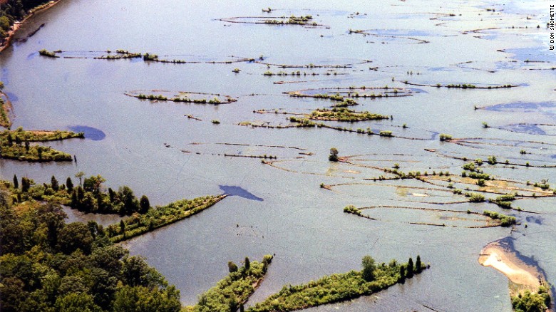
Through the end of May, the team is exploring the remote jungle, mangrove forests and lagoons at the ancient port site of Vista Alegre (“happy view” in Spanish) where the Caribbean meets the Gulf of Mexico at the northeastern tip of the Yucatan Peninsula.
Scientists believe the port was part of an important trading network and was used at various times between about 800 B.C. and A.D. 1521, the date scholars use to designate the start of Spanish rule.
“The maritime Maya have been described much like ancient seagoing Phoenicians. They traded extensively in a wide variety of goods, such as bulk cotton and salt, and likely incense from tree sap called copal, jade, obsidian, cacao, Quetzal and other tropical bird feathers, and even slaves,” said Dominique Rissolo, Ph.D., expedition co-chief scientist and director of the Waitt Institute in La Jolla, Calif.
“Maya trade was far-ranging between the Veracruz coast of modern Mexico and the Gulf of Honduras, with each port a link in a chain connecting people and ideas. Yet there is still much to learn about the extensive history and importance of the maritime Maya and how they adapted to life by the sea.”
“Maritime economies were strengthened and far-ranging trade routes were established between A.D. 850 and 1100,” said Jeffrey Glover, Ph.D., expedition co-chief scientist with Georgia State University’s Department of Anthropology in Atlanta.
“It was during this time when the Maya at Chichen Itza relied increasingly on maritime commerce to maintain and extend control over much of the Yucatan peninsula. The period most associated with Maya seafaring followed, between A.D. 1100 and 1521.”
Recent archaeological work at Vista Alegre included completion of an architectural map of the site, test excavations to obtain cultural materials, and a 13-mile reconnaissance of coastal environments that revealed a number of small ancient and historical sites and cultural features.