Ancien Maritime History
Historical Naval Battles and Other Marine Tale News
-
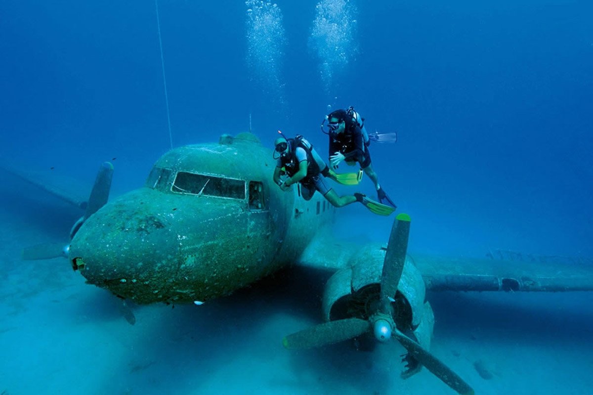
Underwater history : 255 artifacts found in Turkish seas
- On 27/11/2021
- In Ancien Maritime History
- 0 comments
From Daily Sabah
The underwater archaeological excavation and research ventures of Turkey, which has a coastline of approximately 8,300 kilometers (5,157 miles), were started by foreign teams with the work at the Bronze Age Gelidonya Shipwreck, near the Finike district of Antalya province on the Mediterranean coast, in 1960.Turkish scientists and divers have continued to bring important cultural heritage up from the depths of the blue waters ever since.
While the excavations carried out in Yassıada in 1967-1969, in glass wreck salvaged from the Serçe harbor in 1979, and in the Uluburun Shipwreck off Kaş in 1984 constitute important milestones of Turkish underwater archaeology, a total of 10 underwater archaeological excavations were also conducted this year in the country.
As part of the archaeological underwater research, 255 artifacts have been handed over to Turkish museums so far.
The wreckage of the world's oldest trade ship from the Bronze Age contains works of art from the Archaic period and features the only statue examples found in the Mediterranean. The Ottoman shipwreck, which includes findings that will illuminate the Ottoman navy, is among the important discoveries of the latest archaeological excavations.
Efforts are also underway to establish underwater archaeology museums on the coasts of Turkey's seas so that the artifacts that have been discovered in the scientific, underwater studies can be exhibited on site.
Harun Özdaş, excavation head of Turkey’s Shipwreck Inventory Project, spoke with Anadolu Agency (AA) about his experience in underwater excavations and research.
Özdaş, who is also an archaeology professor at the Institute of Marine Science and Technology at Izmir-based Dokuz Eylul University, said that shipwrecks lie at depths varying between 30-60 meters (98-196 feet) and each meter descended during the dive is a journey to the past.
-
Japan’s Atlantis? The unsolved underwater mystery
- On 27/09/2015
- In Ancien Maritime History
- 0 comments
Photo: Robert SchochBy Kate Schneider - News.Com.Au
When scuba diving instructor Kihachiro Aratake plunged into the water off the coast of the Japanese island of Yonaguni in 1986, he discovered an incredible sight.
Six metres below the surface lay a series of monoliths that he described as appearing to be “terraced into the side of a mountain”. The huge rectangular formations had strikingly perfect 90 degree angles, including straight walls, steps and columns.
Over the following years experts descended upon the site in a bid to determine whether the structure was natural or man-made.
Yet to this day, it remains a great unsolved mystery. Initially it was proposed that the Yonaguni Monument was built when the area was above sea level some 10,000 years ago.
So could ‘Japan’s Atlantis’ be a remnant of a preglacial civilisation that was eventually inundated ? Or could it be the result of an earthquake, putting it at 2000-3000 years old ? Experts disagree.
As the structure was mapped out over the following years, more details came to light. Divers found what appeared to be a huge arch, as well as temples, carvings, paved streets and a large pyramid-like structure measuring 76 metres long at its base. -
Atlantis' legendary metal found in shipwreck
- On 07/01/2015
- In Ancien Maritime History
- 0 comments

By Rossella Lorenzi - News DiscoveryGleaming cast metal called orichalcum, which was said by Ancient Greeks to be found in Atlantis, have been recovered from a shipwreck that sunk 2,600 years ago off the coast of Sicily.
The lumps of metal were arriving to Gela in southern Sicily, possibly coming from Greece or Asia Minor. The ship that was carrying them was likely caught in a storm and sunk just when it was about to enter the port.
He noted that the 39 ingots found on the sandy sea floor represent a unique finding."Nothing similar has ever been found," Tusa said. "We knew orichalcum from ancient texts and a few ornamental objects."
Indeed orichalcum has long been considered a mysterious metal, its composition and origin widely debated.
According to the ancient Greeks, it was invented by Cadmus, a Greek-Phoenician mythological character. The fourth century B.C. Greek philosopher Plato made orichalcum a legendary metal when he mentioned it in the Critias dialogue.
-
Diver pinpoints Medieval shipwreck site found at Isles of Scilly
- On 19/08/2014
- In Underwater Archeology
- 0 comments

From Western Morning NewsFragments of a ship believed to be one of the first ever documented to have fallen victim to the notorious rocks of the Isles of Scilly more than 700 years ago have been located.
Diver and historian Todd Stevens, who has an impressive pedigree as a latter day underwater treasure hunter, has this summer located two potential archeological sites in the waters around his home on the islands.
In one, he found pottery which he believes could have come from a ship which sank in 1305 - the only Medieval vessel which has been documented as lost at Scilly and possibly its oldest shipwreck site.
Meanwhile on the second he found a bottle dated around 1780 to 1820 and remains of a cargo which he believes may have originated just 28 miles away in Penzance.
Mr Stevens said they were exciting finds.
“It is certainly one of the oldest sites at Scilly and could possibly be the oldest,” he said.
“I have been working at these sites all season. It’s about following a trail which leads to a discovery.”
The finds, which have been declared to the Receiver of Wrecks, who administers marine salvage, were located around Nut Rock, near to the inhabited island of Tresco.
Mr Stevens said he found some items of pottery and lifted them from the site before suspecting there was actually a wreck in the area.
However, after finding even more items, he realised he had stumbled across a wreck site.
-
New secrets from 'Bay of the Pirates' warship that sunk 2,300 years ago
- On 07/06/2012
- In Ancien Maritime History
- 0 comments
By Michael Bernstein - American Chemical Society
A new study puts some finishing touches on the 2,300-year history of the beak-like weapon that an ancient warship used to ram enemy ships in the First Punic War, the conflict between ancient Rome and Carthage.The report, in ACS' journal Analytical Chemistry, also identifies a major threat that conservators must address in preserving this archaeological treasure for future generations.
Patrick Frank and colleagues explain that the ram, called a rostrum, was found in 2008 under 22 feet of water, 150 feet offshore from Acqualadrone (which means "Bay of the Pirates") in northeastern Sicily.The Acqualadrone rostrum is bronze, with a wooden core that was preserved because of burial beneath the seafloor.
Carbon-14 dating suggests that the warship sank around 260 B.C. after being damaged in the battle of Mylae during the opening stages of the First Punic War, which may have been among the largest wars of its time.
Earlier research localized the metals in the bronze to mines in Spain or Cyprus.
The authors, from the SLAC National Accelerator Laboratory at Stanford University and the University of Palermo, set out in the new research to learn more about the origin and condition of the rostrum wood.
-
Anthropology researcher searches for slave-era shipwreck
- On 20/01/2012
- In Ancien Maritime History
- 0 comments

Photo Elise Apelian
By Liza Dee - GW Hatchet
Anthropology professor Stephen Lubkemann thinks his planned trek into the sea will soon help shape the understanding of one of the ugliest aspects of human history: the trans-Atlantic slave trade.
Lubkemann has spent two years pinpointing the site of a shipwreck near Cape Town, South Africa that killed more than 200 slaves being transported between East Africa and the Americas during the 1790s.If he reaches the sunken ship, he says the findings will add the first archaeological evidence to the 18th-Century slave trade.
The search of the South Atlantic Ocean is one of five research initiatives piloted by GW professors that now have the support of an 18-month-old joint fund between the University and the Smithsonian Institution.The time since the partnership’s establishment was spent vetting project ideas and selections were announced Jan. 12.
Alongside Smithsonian curator Paul Gardullo, Lubkemann will lead a team of nine researchers from the U.S. and South Africa to the ocean floor in hopes that getting an up-close view of the shipwreck will reveal historical details.
This is an area where archaeology could possibly make some contributions that would be unique,” Lubkemann said.
He added that although other teams of archaeologists have already studied shipwrecks from the trans-Atlantic slave trade, this effort would be the first to analyze a ship that was carrying slaves when it sunk.
Examining the ship’s size and technology will reveal goals and priorities for the slave traders – like concern about a British blockade or the importance of speedy transport, Lubkemann said.
-
China offers Sri Lanka help to find silk route wrecks
- On 20/01/2012
- In Ancien Maritime History
- 0 comments
From Yahoo News
Chinese authorities are seeking permission to explore Sri Lanka's coastline for possible Chinese ship wrecks from the ancient Silk Route era, an official said Wednesday.
Sri Lanka, an Indian Ocean island, was a key trading post along the ancient Silk Route which saw silk, spices and handicrafts travel by road and sea between Asia and Europe.
The seas around the island's southern port of Galle are known to have at least 75 ancient ship wrecks, of which 25 have been well documented.
The unsolicited offer by Science Foundation of China to deploy experts to look for vessels along Sri Lanka's coast was under consideration, Director General of Archaeology Senarath Disanayake told AFP.
He said, however, that the Chinese had asked to keep half of all antiquities brought up from the ocean bed -- a condition Sri Lanka could not agree to.
"They also want us to pay for a vessel to carry out the exploration and that is something we can't afford," Disanayake said.
China is increasing its presence in Sri Lanka with the construction of a deep-sea port in the island's south as well as several other key infrastructure projects.
Sri Lanka's immediate neighbour India has become sensitive about increasing Chinese influence on the island.
-
Map Arctic explorer Willem Barentsz foresaw northern passage in 1596
- On 08/06/2011
- In Ancien Maritime History
- 0 comments

By Geert Groot Koerkamp - RNW
The dream of a 16th century Dutch explorer could become reality in 2020. In 1596, Willem Barentsz set off to sail a route across the Arctic Ocean to Asia. He died in the attempt. But as a result of global warming, it looks like he would have had more luck had he tried four centuries later.
Dutch school children all know the story of Willem Barentsz, who got stuck in the ice in the autumn of 1596, on his quest for a northern route to the Indies.
The sailors survived the bitter arctic winter in a house they built themselves on the now Russian island of Nova Zembla.Barentsz ship’s logs recounting the story of that punishing winter have recently been translated into Russian.
But that’s not the only reason the Dutch explorer is currently topical in Russia. The voyage he dreamt of along the north coast of Russia to Asia will soon become possible. At least, that’s the belief of Professor Louwrens Hacquebord, director of the Arctic Centre in the northern Dutch city of Groningen. He made his prediction at the launch of the translation in Moscow.
“On the basis of 30 years of satellite photos that the sea ice is retreating considerably,” says Professor Hacquebord. “If it goes on like this, you can expect the sea to be free of ice by 2020.”
This offers possibilities for shipping, although certainly at first ships will have to be prepared for a lot of drifting ice. “It will still be a dangerous ocean, even if there is sometimes ice and them sometimes not. It won’t make the sea any safer,” the professor says. Ships will need ice reinforcement and good search and rescue facilities.Willem Barentsz has inspired many arctic explorers. One of them, Vladimir Vize, even learnt Dutch to be able to read the story of Barentsz voyages in the original language, says arctic specialist Pjotr Bojarski.
A first censored translation of Barentsz’ log edited by Vize was first published in 1936. All references to God were conscientiously removed by Stalin’s censors.
-
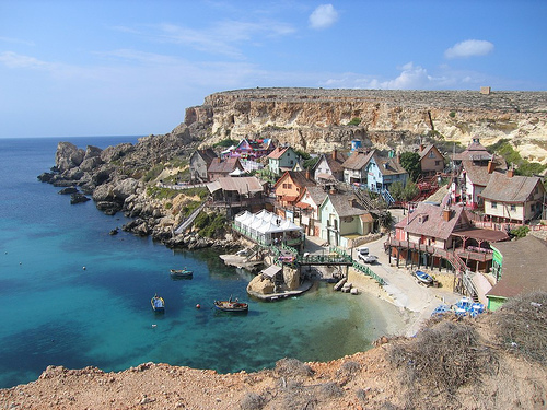
Diver searching near Malta for St. Paul's shipwreck
- On 06/05/2011
- In Ancien Maritime History
- 0 comments
By Kay Campbell - Chron
Even long before the times of Jesus and the Apostle Paul, Malta was the rocky knob at the western edge of the Roman Empire, the place where the leftovers of the Mediterranean Sea washed up and dug in.
And Malta is the site of what Huntsville software salesman John Harkins thinks will be the last and best quest of his life.
Harkins, a mild-mannered, Bible-reading, Church of Christ deacon and marine biologist, is determined to be the first person since the biblical Luke to see evidence of the ship that carried Paul nearly to Rome.
"I'm quite in the minority in thinking there might be some remnant," Harkins said, unrolling charts of the island on his desk at work. "But I know we're going to find something, though it may not be from Paul's wreck."
According to Acts 27, a chapter in Luke's history of the nascent Christian movement, a huge ship loaded with grain, sailors, soldiers, prisoners and passengers crashed into the coast at the end of a 14-day storm.
The ship broke in half, spilling everyone into the sea. Miraculously, the entire crew was able to struggle to shore, where they were met by the inhabitants of the 200-mile-long island, who built them a fire.
"The natives showed us unusual kindness," Luke writes.
Harkins said Malta's government places a high value on caring for and understanding relics washed on its shores. Museums catalog ancient weapons, structures, tools and, of course, fragments of the shipping trade that made Malta a crucial outpost of vessels attempting to round the Italian boot to get to Rome.
"God put that ship there, and I figure he put it where he wants it," Harkins said. "He gave it to the Maltese people, and frankly, he couldn't have given it to people who do more to preserve their heritage — and it's their heritage, along with the rest of us."
Harkins can't remember a time when the story of Paul's shipwreck didn't fascinate him. It was one of the stories that leapt out of the dim and musty antiquity of ancient stories to snap into Technicolor. -
Indians first to ride monsoon winds
- On 24/04/2011
- In Ancien Maritime History
- 0 comments
By G.S. Mudur - Telegraph India
Mariners from India’s east coast exploited monsoon winds to sail to southeast Asia more than 2,000 years ago, an archaeologist has proposed, challenging a long-standing view that a Greek navigator had discovered monsoon winds much later.
Sila Tripati at the National Institute of Oceanography (NIO), Goa, has combined archaeological, meteorological, and literary data to suggest that Indian mariners were sailing to southeast Asia riding monsoon winds as far back as the 2nd century BC.
A 1st century AD Greek text, Periplus of the Erythreaean Sea, and a contemporary Roman geographer named Pliny have claimed that the Greek navigator, Hippalus, discovered the monsoon winds and the route across the Arabian Sea to India around 45 AD.
But Tripati has now used multiple lines of evidence — from inscriptions on ancient Indian coins to bronze pottery from an archaeological site in western Thailand — to question that claim and argue that mariners of India’s east coast knew about the monsoon winds perhaps about 200 years before Hippalus. Tripati’s research is published in the journal Current Science from the Indian Academy of Sciences.
“This work provides fresh insights into the maritime history of India,” said Ruby Maloni, professor of ancient Indian history at the University of Mumbai, who was not connected with the NIO research but is an expert on ancient trade contacts.
Tripati has analysed monsoon wind patterns in the Bay of Bengal to show how sailors could have used them to their advantage. The northeast monsoon winds between October and February help ships sail from the east coast of India to Sri Lanka and to southeast Asia. And between May-June and September, the southwest monsoon winds can drive ships from southeast Asia to the east coast of India.
“The strongest evidence to support this idea comes from ancient literary works and the timing of a festival observed in Orissa even today,” said Tripati, a scientist at the marine archaeology division at the NIO.
Both the Buddhist Jataka tales that date back to the 4th century BC as well as Tamil Sangam texts from around the 1st century BC mention ships moving through the force of winds or sails, Tripati said.
The monsoon winds have historically been linked to the Arabian sea and the western zone of the Indian ocean, Maloni said. This work throws light on how the winds were also used on the eastern side of India centuries earlier.
She cautioned that the new hypothesis is based on inferences and indirect deductions. “But the sources used to make this proposal such as the Tamil and Buddhist literary works and archaeological remains are indeed legitimate,” -
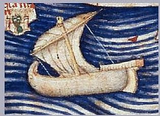
St Paul’s shipwreck in a 15th-century Codex
- On 11/02/2011
- In Ancien Maritime History
- 0 comments

By Joe Zammit Ciantar - The Malta Independent
Among the manuscripts treasured by the Biblioteca Nazionale Universitaria of Turin, there is a codex dating from the early 15th century, entitled De insulis et earum proprietatibus (‘Of islands and their properties’) – possibly complimenting Giovanni Boccaccio’s De montibus et silvis, de fontibus et lacubus et fluminibus ac etiam de stagnis et paludibus nec non et de maribus seu diversis maris nominibus.
It was written by Florentine Domenico Silvestri. I came across and consulted this MS in December 1995.
The De insulis and other codices had escaped the fire which destroyed other manuscripts and the church of Santo Spirito in the second half of the 15th century. It had another very narrow escape when the Biblioteca in Turin caught fire on the night between Monday 25 and Tuesday 26 January 1904.
In this manuscript – a sort of an encyclopedia with information about islands – reference is made to both of the islands of Malta and Gozo. Although the indication may not be precise, Silvestri cites an island where, he writes, the shipwreck of St Paul took place.
In the days of the Florentine writer, it was known as Mitellino. This does not seem to match with the author’s opinion: ‘quod mihi non bene congruit’.Most of the facts given under this name are related to the passage taken from the Acts of the Apostles, where Luke narrates St Paul’s shipwreck on an island, the welcome he was given by the inhabitants, the bonfire the people lit to warm themselves, the viper that went up the Apostle’s hand and the healing of Publius’ father (Silvestri states ‘brother’).
This could have been taken from one of the ‘Vulgata Latina’ – Latin Vulgate – copies of the Bible of the times. Silvestri wrote when printing was not yet ‘invented’, and the small number of copies of Latin translations available and perhaps within reach of the few who could read were chained to benches.Silvestri summarised this biblical event in his own words.
-
Sailing into antiquity
- On 26/01/2011
- In Ancien Maritime History
- 0 comments

By Colin Nickerson - Boston
The archeological digs at have yielded neither mummies nor grand monuments.But Boston University archeologist Kathryn Bard and her colleagues are uncovering the oldest remnants of seagoing ships and other relics linked to exotic trade with a mysterious Red Sea realm called Punt.
“They were the space launches of their time,’’ Bard said of the epic missions to procure wondrous wares.
Although Nile River craft are well-known, the ability of ancient Egyptian mariners to ply hundreds of miles of open seas in cargo craft was not so fully documented.
Then the team led by Bard and an Italian archeologist, Rodolfo Fattovich, started uncovering maritime storerooms in 2004, putting hard timber and rugged rigging to the notion of pharaonic deepwater prowess.
In the most recent discovery, on Dec. 29, they located the eighth in a series of lost chambers at Wadi Gawasis after shoveling through cubic meters of rock rubble and wind-blown sand.
Only a few days earlier, Bard had been grading term papers in chilly Boston; now, with flashlight and trowel, she was probing a musty manmade cavern, one that might date back more than 4,000 years.
“When the last layer of sand was removed, stale, fetid air rushed from a crack,’’ Bard said by mobile phone from the dig site, a dried-out water course beside the Red Sea.
The reconnaissance of the room and its relics will take time and caution. The chamber’s most likely contents include ship parts, jugs, trenchers, and workaday linens, as well as hieroglyphic records.
“It’s a storeroom, not a royal tomb,’’ Bard stressed.
However prosaic they seem, the finds at Wadi Gawasis - including the ancestor of the modern package label - really speak of the glitter, gold, and glory of a long-ago civilization that bewitches us still. -
Carausius was a pirate, a rebel and the first ruler of a unified Britain
- On 30/07/2010
- In Ancien Maritime History
- 0 comments
By Alan Clayson - The Independant
One afternoon earlier this summer, in a Somerset meadow, David Crisp stumbled upon 52,000 Romano-British coins, the second-largest such hoard of its kind ever unearthed – and presently on exhibit in the British Museum.Almost 800 of these were minted during the reign of Carausius, which lasted from around AD286 until AD293, the first ruler since the conquest in AD43 to govern Britain without the authority of Rome – and a much-overlooked historical figure.
As Roger Bland, the museum's head of portable antiquities, says, "This find presents us with the opportunity to put Carausius on the map. Schoolchildren across the country have been studying Roman Britain for decades, but have never been taught about Carausius – our lost emperor."
For nigh on 10 years prior to its recapture, Britain enjoyed the best of both worlds as a unified and isolationist nation-state that could still claim affinity with the greater dominion of Rome across the Straits of Dover.
Indeed, some of the coins that activated Crisp's metal detector are embossed with the motif "AUGGG" (the three 'g's denoting three augusti, or Roman emperors), stressing that Carausius was on equal terms with the other two emperors – one in Constantinople, one in Rome itself – of an increasingly more fragmented federation, riven with incessant warfare.
Regarded, nevertheless, as a glorified squatter, Carausius was recognised only under official sufferance – and, with his passing, his rule was shrugged off in contemporary records as a triviality, just one of around 50 similar territorial uprisings. As a result, an important episode in our island story remained shrouded in distortion and obscurity.
There's no mention of Carausius in the Anglo-Saxon Chronicle, and what might be described as the sole major biography is P H Webb's The Reign and Coinage of Carausius, which is 88 pages in length and was published in 1908.
The raw facts are that Mausaeus Carausius was born of a humble family dwelling in what was to smoulder into modern Belgium. On the strength of the coins he minted, he was burly, multi-chinned and unshaven – with the intimation that beneath layers of fat, the muscle was rock-hard, and that, if slighted, he could inflict red-fisted reprisal.
He began his working life as a common sailor, serving eventually as a steersman aboard a merchant vessel. His career took off when Rome, attempting to bolster its supremacy by employing the skills of conquered people, sought parochial bruisers to assist in the crushing of revolt in north-eastern Gaul.
Emerging as a natural rabble-rouser, Carausius distinguished himself during these expeditions on land, but, a mariner by instinct, he was better placed to rise through the ranks of the newly reconstituted Classis Britannica – the British fleet – being promoted to high admiral after visiting Rome for what amounted to a job interview.
Unaware of any hidden agenda, the Senate commissioned Carausius to patrol the waters of northern Europe for buccaneers, mostly from Baltic and Scandinavian regions. Based in Gesoriacum (Boulogne), Carausius seemed to undertake this task with ruthless competence – according to Eutropius's Epitome of Roman History, penned a century later – until bureaucratic diligence brought to the ears of Rome that not only was he apprehending these nascent Vikings, but was appropriating their stolen goods. It was hinted that he was actually in league with them. -
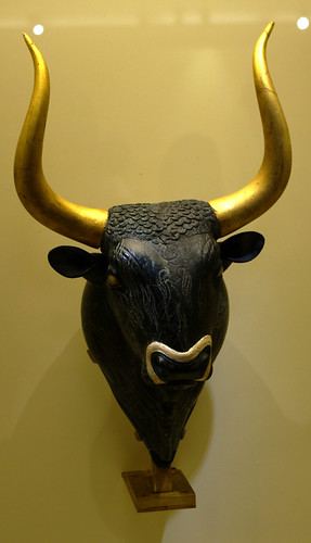
The Minoan civilization
- On 01/06/2010
- In Ancien Maritime History
- 0 comments
By Owen Jarus - Heritage Key
Where is Atlantis ? Ever since Plato mentioned the existence of the fabled island-city in the 4th century BC, archaeologists, historians and adventurers have spent much time and ink trying to chase down its origins.
“Now in this island of Atlantis there was a great and wonderful empire which had rule over the whole island and several others, as well as over parts of the continent, and, besides these, subjected the parts of Libya within the columns of Heracles as far as Egypt, and of Europe as far as Tyrrhenia.” – From Plato’s Timaeus – Translation by Benjamin Jowett
One of the suggested locations of Atlantis is the island of Crete, just off the Greek coast.In around 2000 BC it was home to the Minoans. Sir Arthur Evans, one of the first people to excavate the civilization, named the Bronze Age civilization after King Minos, a mythical king who is said to have ruled from Crete in ancient times.
Most of what we know about the Minoans comes from the architecture and artefacts they left behind. While they were a literate people, the script they produced, which archaeologists call Linear A, remains un-deciphered.
The Minoans did not rise in isolation. In circa 2000 BC the Egyptians were re-unifying into their Middle Kingdom period. At the same time, in Mesopotamia, the Assyrians were growing into a massive state.
If Atlantis was indeed the city of the Minoans, then Plato had a really inflated idea of their military prowess. There is little evidence that the Minoans controlled more territory than Crete and some nearby islands.They never conquered Egypt or controlled large sections of Europe, as the people of Atlantis are said to have done. In fact, Sir Arthur Evans was unimpressed by the lack of Minoan fortifications and deduced that they were a peaceful people who lived in a sort of “pax Minoica.”
Today we know that they were interested in military affairs. There are fortifications on Crete, including some just-discovered walls at Gournia.
-
Hints of man's earliest voyages
- On 20/03/2010
- In Ancien Maritime History
- 0 comments
By Gina Macris - Projo
A team of archaeologists led by Thomas F. Strasser, an associate professor of art history at Providence College, has made discoveries in Crete that suggest man’s predecessors had the ability to navigate the seas much earlier than the first known voyage 60,000 years ago.
Strasser’s team, working under the auspices of the Greek Ministry of Culture, found Stone Age tools at least 130,000 years old on the southern coast of Crete two summers ago — discoveries that were made public only last month.
The presence of the tools on Crete — an island for 5 million years — implies that the predecessors of Homo sapiens had the ability to navigate the seas.
“This was a life-changing experience,” he said of the expedition to Plakias, a tourist spot on the southwest coast of Crete.
One day, at Preveli Gorge just outside the town, team member Curtis Runnels, a professor of archaeology at Boston University, was talking to a few PC students in the group about the materials and methods of Stone Age toolmaking.
Runnels’ wife picked up a piece of quartz and put it in her husband’s pocket so he would have raw material for a later tool-making demonstration he had planned.
Back at their lodgings, the rock lay on a balcony table as a paperweight for a day or so.
-
Searching for Zheng
- On 09/03/2010
- In Ancien Maritime History
- 0 comments

By Ishaan Tharoor - Times
One of the more famous paintings of the medieval Ming Dynasty, which ruled China for three centuries, is that of a court attendant holding a rope around a giraffe.An inscription on the side says the animal dwelt near "the corners of the western sea, in the stagnant waters of a great morass."
According to legend, the giraffe was found in Africa, along with zebras and ostriches, and brought back with the grand 15th century expeditions of Zheng He, China's greatest mariner.
More than half a millennium later, Zheng has become a potent symbol for modern China.In 2005, the country marked the 600th anniversary of the seven voyages undertaken between 1405 and 1433 by Zheng's vast "treasure fleets" with nationwide celebrations; the opening ceremony of the 2008 Olympic Games in Beijing dramatized his explorations from Southeast Asia to the Middle East and the shores of Africa.
On Feb. 26, China's Ministry of Commerce announced it was funding a three-year project with the assistance of the Kenyan government to search for Ming-era vessels that had supposedly foundered off the East African coast."Historical records indicate Chinese merchant ships sank in the seas around Kenya," Zhang Wei, a curator for a state museum, told China's official Xinhua news agency. "We hope to find wrecks of the fleet of the legendary Zheng He."
There is more than historical curiosity behind these new efforts. For centuries after his expeditions, Zheng — a Muslim eunuch — slipped out of public awareness, obscured by the rise and fall of new dynasties. Talk of his exploits was revived briefly at the beginning of the 20th century as the fledgling Chinese republic sought to build a navy in the shadow of imperial Japan.
But experts say his place as a patriotic national hero has only been truly cemented in the past two decades, in parallel with China's geopolitical rise — and the growth of its significant economic presence in many African nations and other countries around the Indian Ocean.
-
Searching for Paul's Shipwreck on Malta
- On 26/02/2010
- In Ancien Maritime History
- 0 comments
By Chuck Holton - CBN
The tiny island of Malta in the middle of the Mediterranean Sea has a rich history as one of the oldest Christian communities in the world.
It all started with a shipwreck, as told in the book of Acts, about 60 AD while the apostle Paul was enroute to Rome.Boarding an Alexandrian grain freighter on the isle of Crete, a fierce Nor'easter blew the ship off course. It looked like all was lost.
"On the fourteenth night, they were still being driven across the Adriatic sea when the sailors sensed land approaching," said Douglas Gresham, producer of Chronicles of Narnia and a resident of Malta."They took soundings and found that the land was 120 feet deep. A short time later they took soundings again and found that it was 90 feet deep. Fearing that we would be dashed against the rocks, the sailors dropped four anchors from the stern, and prayed for daylight."
"When daylight came, they did not recognize the land. But they saw a bay with a sandy beach, where they decided to run the ship aground if they could," he continued. "Cutting loose the anchors, they left them in the sea."With the storm still raging, the ship struck a sandbar, and began to break apart. With the vessel and her cargo a total loss, the nearly 300 men on board swam for their lives. Miraculously, everyone survived.
"Once safely on shore, we found out that the island was called Malta," Gresham explained of the sailors experience.
And so began a Christian influence in Malta that has continued down through the centuries. Today, it is the most religious nation in Europe -- 98 percent of its citizens are members of the Catholic Church.
Saint Paul is memorialized throughout the island, no where more than in Saint Paul's bay, where tourists come to visit the Shipwreck Cathedral, and see the spot where most believe Paul's ship ran aground nearly 2,000 years ago.
-
Sailing Against Conventional Wisdom
- On 13/02/2010
- In Ancien Maritime History
- 0 comments

By Dalya Alberge - Online WSJ
It takes a brave soul to rewrite history by sailing against current thought. More than 500 years after Christopher Columbus "discovered" America, another seaman is doing just that, entering previously uncharted academic waters with claims that other "Europeans" -- the Minoans -- got there first, thousands of years earlier.
Gavin Menzies, 72 years old, is drawing on his experience as a former British Royal Navy submarine commander to prove in a book he is writing that the Minoans were such supreme seafarers that they crossed an ocean and discovered the New World 4,000 years ago.
Eight years after he made controversial headlines with his first American history book, "1421: The Year China Discovered America," which sold more than a million copies in 130 countries, he may spark debate anew by claiming that the Bronze Age civilization of Crete, which built magnificent palaces, devised systems of writing and developed a trading empire, got rich on vast quantities of copper mined in America.
Transworld Publishers undertook his first book, in which he claimed that a Chinese eunuch led a fleet of junks to America 71 years before Columbus.The book led to invitations to lecture at universities including Harvard, to an honorary professorship at Yunnan University in China, to the sale of film rights to Sky Motion Pictures and to HarperCollins snapping up the sequel in 2008, "1434: The Year a Magnificent Chinese Fleet Sailed to Italy and Ignited the Renaissance."
"Revisionist history tends to sell exceptionally well," says Luigi Bonomi, a leading literary agent who represents Mr. Menzies. "There is a huge audience eager to read new things about history." -
Spanish twists provoke research
- On 28/12/2009
- In Ancien Maritime History
- 0 comments
By Annette Lambly - The Northern Advocate
An Oxford-educated researcher is investigating whether Spanish sailors visited New Zealand 116 years before Abel Tasman. Historians generally accept that Tasman, a Dutchman, first sighted the Southern Alps on December 13, 1642.
But Qatar-based researcher Winston Cowie, who spent part of his childhood in Dargaville, is investigating whether
the Spanish visited New Zealand as early as the start of the 16th century.
A sighting of a caravel wreck near Aranga on Northland's west coast by Dargaville's shipwreck explorer Noel Hilliam 25 years ago was the catalyst for Mr Cowie's project. Sketches suggested the caravel is the San Lesmes, which disappeared in the Pacific in 1526.
Mr Hilliam says 22 of the 53 crew listed on the 80-tonne caravel came from a Spanish town called Aranga - the same as the Northland area close to the wreck. Mr Hilliam said in June this year Mr Cowie had spent a month in the northwest Spanish town where the main street was called "Rua Tui" - a Maori name.
Mr Cowie found what he believes are two ancient pohutakawa trees at La Coruna, not far from Aranga.
Mr Hilliam says that in June next year, a Lincoln University scientist, Dr Jonathan Palmer, will take a core samples to determine the age of the Spanish trees.
Further speculation of the Spanish visitors arises from a number of local Maori surnames that also have Spanish derivatives. -
A Jamestown shipwreck 400 years ago
- On 14/07/2009
- In Ancien Maritime History
- 0 comments
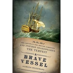
By Hobson Woodward - History News Network
News of shipwrecks reached London regularly during the lifetime of William Shakespeare.The frequency of travel by water and the fragility of wooden sailing vessels made disaster at sea a relatively common occurrence.
Thus it is all the more striking that the playwright chose one particular wreck—the loss of a Jamestown ship on uninhabited Bermuda four centuries ago this month—as an inspiration for his ethereal Tempest.
The Sea Venture was voyaging from London to the two-year-old colony on the Virginia coast in the summer of 1609 when it encountered an intense hurricane.After four days of punishing violence the ship came to rest on a Bermuda reef. All 153 people aboard survived to be remembered as the first to occupy the mid-Atlantic isle.
A year later when some of them returned home and told their story, Shakespeare ensured they would also make literary history as a source for his last solo play.
-
Discovered: A sunken island, an Indian Ocean Atlantis ?
- On 02/04/2009
- In Ancien Maritime History
- 2 comments
From Ground Views
Marine archaeologists have just discovered evidence of a large submerged landmass southeast of Sri Lanka. They believe it could be a legendary lost island closely linked to the culture and history of Sri Lankan people.
The discovery was made by a team of Dutch and Sri Lankan scientists based on satellite maps and underwater sample extractions from the deep sea. Preliminary data need to be verified by a deep sea submersible expedition during 2009 - 2010, according to a member of the research team who did not want to be identified.
The landmass is estimated to be between 450,000 and 475,000 square kilometres, which is about seven times the total land area of Sri Lanka.
“This could well be the long lost island of Irisiyawa, which is euphemistically mentioned in our chronicles and hinted at in the writings of Greek historians,” said Dr Godwin Samarawickrama, a maritime historian at the Indian Ocean Institute based in Melacca, Malaysia.
He added: “The existence of such an island has been speculated and talked in hush-hush terms among divers and archaeologists for decades. This is the Indian Ocean’s own version of Atlantis !” -
Archaeology office lets 7,000-year-old boats rot away
- On 15/03/2009
- In Ancien Maritime History
- 0 comments

From The Local
A pair of stone-age boats, thought to be the oldest in , have been allowed to rot in a partially collapsed shed while the northern German regional archaeology authorities stood by broke and helpless, it emerged this week.
The two 7,000-year-old wooden boats and a third one thought to be around 6,000 years old, were hailed as a sensation when they were found during construction work on the Baltic coast near Stralsund in Mecklenburg-Vorpommern seven years ago.
But now they are effectively ruined, after a lack of funds resulted in them being stored inappropriately. “It is a loss for Germany if not for the whole world,” said Andreas Grüger, director of the Stralsund historical museum. -
Is this Atlantis ?
- On 21/02/2009
- In Ancien Maritime History
- 0 comments
By Virginia Wheeler and Rhodri Phillips
This is the amazing image which could show the fabled sunken city of Atlantis. It shows a perfect rectangle the size of Wales lying on the bed of the Atlantic Ocean nearly 3½ miles down.A host of criss-crossing lines, looking like a map of a vast metropolis, are enclosed by the boundary.
They seem too vast and organised to be caused naturally. And last night the possibility of an extraordinary discovery had oceanographers and geophysicists captivated.
The site lies 620 miles off the west coast of Africa near the Canary Islands — a location for Atlantis seemingly suggested by the ancient philosopher Plato.
He believed it was an island civilisation sunk by an earthquake and floods around 9,700BC — nearly 12,000 years ago.
The “grid” showed up on Google Ocean, a Google Earth extension that uses a combination of satellite images and marine surveys.
-
Les épaves de Mahdia et l'aventure de l'archéologie subaquatique
- On 06/02/2009
- In Ancien Maritime History
- 0 comments
Actualités de Tunisie
Savez-vous que le Commandant Jacques Yves Cousteau, le grand marin et explorateur français, qui a dévoilé le mystère de l'univers peuplant le monde sous marin, a entrepris avec son équipe, en 1948, la première campagne en Méditerranée en explorant l'épave romaine de Mahdia.
C'était la première opération d'archéologie subaquatique après la découverte en 1907 par des pécheurs d'éponge, de l'épave d'un navire grec qui a échoué il y'a plus de 2000 ans sur les côtes tunisiennes et les fouilles entreprises entre 1908 et 1913.Cette opération a été couronnée par la production du film "Méditerranée " primé au festival de Cannes en 1951.
Les aventures de cette opération sont racontées, d'ailleurs, dans les deux livres "Le monde du silence" de Cousteau et "Plongées sans câble" du plongeur sous-marin français Philippe Tailliez.
L'histoire des épaves de la ville de Mahdia, considérée par les archéologues comme un véritable musée sous les eaux, est ressuscitée également dans un film documentaire 26 minutes en 1994, "Le trésor de Mahdia" qui raconte l'histoire des recherches et des 30 ans de fouilles pour exploiter entièrement l'épave, portée à jour en 1993 grâce à une opération menée conjointement entre l'Institut national du patrimoine et le musée de Bonn.
Aujourd'hui, six salles du musée du Bardo à Tunis exposent cette découverte de l'archéologie subaquatique, dans un pavillon baptisé "Trésors de la Méditerranée", inauguré le 31 juillet 2000, par le Président Zine El Abidine Ben Ali.Le pavillon comporte plus d'une centaine de pièces antiques récupérées sur le navire qui aurait fait naufrage entre 80 et 70 avant J.C et qui transportait à son bord un étonnant chargement de colonnes en marbre et de statues en bronze.
-
Greek warship explored in slide show
- On 11/11/2008
- In Ancien Maritime History
- 0 comments
From Conn Post
S. Ford Weiskittel, president of the U.S. Trireme Trust, which supported a Greek initiative to test a replica of a fifth century BCE warship, will present a slide lecture on the adventure at Fairfield University on Tuesday, Nov. 11, at 7:30 p.m. in the Multimedia Room of the DiMenna-Nyselius Library. The lecture is free.
A remarkable technological achievement, the Greek trireme was designed to ram other ships. Powered by both sail and oar, with a crew numbering 120, the warships are credited with saving Greek civilization from Persian conquest because of their role in the Athenian victory over the Persian fleet at the battle of Salamis.
About 30 years ago, several British scholars undertook to establish definitively just what a trireme looked like and how it was rowed. Their task was made difficult because nobody had ever found a trireme.While archaeologists had found numerous wrecks of ancient merchant vessels on the bottom of the Mediterranean, it is thought that the trireme ships, built of light wood, probably broke up in the surf, decomposed or were towed away by victorious enemies.
-
Sailing into eternity
- On 02/08/2008
- In Ancien Maritime History
- 0 comments
By Nevine El-Aref
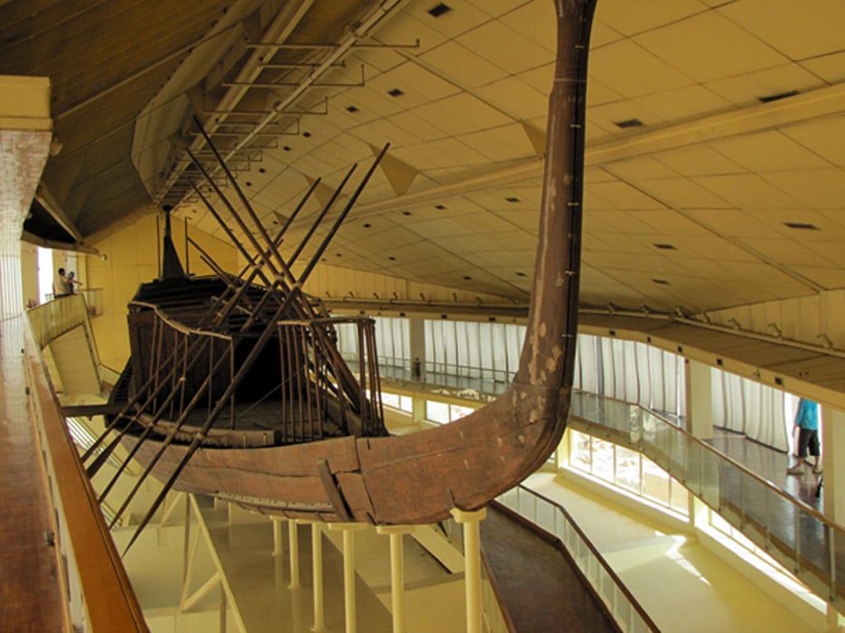
Visitors to the Giza Plateau will be able to view Khufu's second solar boat through a tiny camera 4,500 years after it was buried to ferry the king to eternity.
On the southern side of Khufu's Great Pyramid, a hundred journalists, photographers, cameramen and television presenters gathered inside a five-metre-long metal hanger padded with black fabric.Inside the hanger were 10 leather chairs and an LCD screen showing scenes of Khufu's solar boat in situ.
From last Saturday, Khufu's second solar boat is on show to the public for the first time since its discovery by Egyptian architect and archaeologist Kamal El-Mallakh with Zaki Nour in 1954.
At that time El-Mallakh and Nour found two boat pits during routine cleaning at the southern side of the Great Pyramid.The first pit was found under a roof of 41 limestone slabs, each weighing almost 20 tonnes, with the three westernmost of the slabs being much smaller than the others leading them to be interpreted as keystones.
On removing one of the slabs El-Mallakh and Nour saw a cedar boat, completely dismantled but arranged in the semblance of its finished form.Also inside the pit were layers of mats, ropes, instruments made of flint and some small pieces of white plaster along with 12 oars, 58 poles, three cylindrical columns and five doors.
-
Ancient wooden boat entombed beside Egypt's Great Pyramid
- On 20/07/2008
- In Ancien Maritime History
- 0 comments

From PR-Inside
Archaeologists and scholars will excavate hundreds of fragments of an ancient Egyptian wooden boat entombed in an underground chamber next to Giza's Great Pyramid and try to reassemble the craft, Egyptologists announced Saturday.
The 4,500-year-old vessel is the sister ship of a similar boat removed in pieces from another pit in 1954 and painstakingly reconstructed.
Experts believe the boats were meant to ferry the pharaoh who built the Great Pyramid in the afterlife.Starting Saturday, tourists were allowed to view images of the inside of the second boat pit from a camera inserted through the a hole in the chamber's limestone ceiling.
-
Website following archaeologists to the bottom of the lake
- On 19/06/2008
- In Ancien Maritime History
- 0 comments
From Johns Hopkins University
Follow along online as Johns Hopkins University Egyptologist Betsy Bryan and her team of graduate students, artists, conservators and photographers expand their investigation of Mut Temple this summer, turning their attention to the temple's Sacred Lake.Bryan and her crew are once again in Luxor, Egypt, sharing their work via "Hopkins in Egypt Today," their popular digital diary offering a virtual window into day-to-day life on an archaeological dig.
In collaboration with the American Research Center in Egypt, which also supports Johns Hopkins' work inside the temple proper, Bryan will excavate on the northeast arm of the lake after ARCE's engineers have drained the lake.Excavation will proceed from the region of an ancient stone dock in a swath around 20 meters in breadth down into the basin of the drained lake.
Any materials found in the lake bed will be conserved and desalinated near the bank of the lake before being transferred to a protected environment.The primary goal of this brief dig is to develop procedures for more extensive excavation of the lake next year. The lake will be refilled with less saline water after the work is completed in July and will be drained again next winter when the dig resumes.
The team will consist of former Johns Hopkins graduate student Violaine Chauvet, now a lecturer in Egyptology at University of Liverpool in England; photographers Jay Van Rensselaer and Will Kirk; Hiroko Kariya, stone conservator; Will Schenck and Keli Alberts, artists; Lotfi Hassan, conservator; and three Johns Hopkins graduate students, Ashley Fiutko, Shaina Norvell-Cold, and Meredith Fraser, all of whom are finishing their first-year studies.
Read more...
-
Tsunami or melting glaciers: What caused ancient Atlit to sink ?
- On 05/06/2008
- In Ancien Maritime History
- 0 comments
By Ofri Ilani
At the bottom of the sea, some 300 meters west of the Atlit fortress, lies one of the greatest archaeological mysteries of the Mediterranean basin.About 20 years ago, archaeologists discovered a complex of ancient buildings and ancient graves with dozens of skeletons at the underwater site of Atlit-Yam.
The team of marine archaeologists that excavated the site, headed by Dr. Ehud Galili of the Israel Antiquities Authority, came to the conclusion that an ancient settlement once existed there, but sank beneath the surface of the sea some 8,000 years ago.
The finds at the site, including goat and pig bones and wheat seeds, indicate that it was a well-established community whose residents supported themselves by agriculture, hunting, fishing and animal husbandry.
Over the past few months, a major argument has erupted among researchers over what caused the village and the surrounding region to flood.
A few months ago, a team of geologists from Pisa, Italy published a paper that offers a dramatic theory about how the ancient settlement met its end.
They claim that the settlement was submerged all at once by a tsunami in the Mediterranean, causing the death of dozens of its inhabitants.
This theory attributes the tsunami to something that happened thousands of kilometers away.
-
Exploring the blue depths of the Aegean and Mediterranean
- On 18/04/2008
- In Ancien Maritime History
- 0 comments
From Turkish Press
The coasts of Anatolia are sprinkled with ancient cities whose harbours bustled with ships engaged in the thriving sea trade of the Aegean and Mediterranean.But not every ship made it safely to harbour.
Many were wrecked in storms and sank with their cargoes to the seabed, and the remains of these have lain hidden on the seabed for long centuries.
Wrecks of both merchant and warships each have their historical tale to relate, and are among the underwater sights that fascinate divers today. No other region of the world is so rich in sunken history as the seas around Turkey.
The world's oldest known wreck was discovered at Uluburun near Kas, and after years of work was lifted to the surface and placed on exhibit.
Nautical archaeology began in Turkey, and today is recognised as a distinct branch of archaeology throughout the world.
The first scientific excavation carried out entirely underwater took place at in 1960. This was followed by excavations of the Uluburun, Roman, Yassiada Eastern Roman, Ottoman, Bozburun and Pabuçburnu wrecks, all of which passed into archaeological literature and were followed with interest all over the world.
The timbers of wrecked ships are destroyed within a few years by fireworms, but their cargoes often resist erosion by the sea water for thousands of years. Commodities of many kinds were transported in amphoras, pottery jars with pointed bases and two handles.
Such jars are known to have first been used in the city of Troy in 3000 BC.
The tapering pointed shape enabled them to be stacked safely in ships' holds and kept upright so that their contents did not spill.
As well as wine and olive oil, these jars were used for grain, salted fish and many other dry commodities.
Despite the passage of thousands of years, most of these amphoras remain undamaged at the bottom of the sea.
